
Introduction to the Nujiang River
The Nujiang River (怒江), also known as Gyalmo Ngulchu (རྒྱལ་མོ་རྔུལ་ཆུ།) in Standard Tibetan, is one of the most significant rivers in Tibet and southwestern China. As Tibet’s second-largest river, it originates in the remote Tanggula Mountains on the Qinghai-Tibet Plateau and carves its way through breathtaking landscapes before reaching Myanmar, where it is called the Salween River, and ultimately emptying into the Andaman Sea of the Indian Ocean. This ancient river, with its untamed currents and spectacular gorges, is both a natural wonder and a cultural landmark, sustaining diverse ecosystems and indigenous communities along its course.
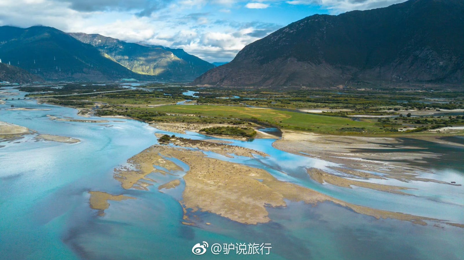
Geographical Features of the Nujiang River
- Length: Approximately 3,240 kilometers, with 2,013 kilometers within China.
- Origin: The river begins in Nakchu Prefecture, Tibet, with its upper reaches known as Naqu (那曲).
- Tributaries: The Soqu River (索曲) joins it before it officially becomes Nujiang.
- Drainage Area: Covers 325,000 square kilometers, of which 137,800 square kilometers are in China.
- Elevation Drop: The river descends over 3,697 meters from its Tibetan origins to its lower reaches.
- Gradient: A steep 2.7‰, resulting in fast-flowing, dramatic rapids and waterfalls.
Unique Natural and Ecological Wealth
Biodiversity and Wildlife
The Nujiang River basin is a biological treasure trove, supporting rare aquatic life and terrestrial species, including:
- Nujiang Schizothoracinae Fish (怒江裂腹鱼) – A species uniquely adapted to fast-moving waters.
- Gymnodiptychus (裸腹重唇鱼) – Found in the upper reaches of the river.
- Dense forests hosting spruce, fir, pine, and other valuable tree species.
- Endangered animals, such as Bengal tigers, golden monkeys, and clouded leopards.
The Nujiang Grand Canyon: A Natural Marvel
One of the most stunning sections of the river is the Nujiang Grand Canyon (怒江大峡谷), renowned as the “Grand Canyon of the East.” This dramatic gorge, with towering peaks and turbulent rapids, is a hotspot for eco-tourism and adventure seekers.
Topographical Features
- Upper Reaches: Gentle slopes and pastoral landscapes supporting nomadic herding.
- Middle Reaches: Deep gorges cutting through the Hengduan Mountains, with sheer cliffs and dense forests.
- Lower Reaches: Fertile farmlands that sustain local agriculture, including barley, wheat, and rapeseed cultivation.
Cultural and Historical Significance
The Nujiang River has long been a vital route for trade and cultural exchange. It played a key role in the Tang-Tubo Ancient Road (唐蕃古道), an essential path connecting Tibet with China’s heartland. The river valley is also home to diverse ethnic communities, each with unique customs and traditions.
Ethnic Groups Along the Nujiang River
- Nu People (怒族) – Indigenous to the riverbanks, named after the Nujiang River.
- Lisu People (傈僳族) – Known for their acrobatics, bamboo bridges, and traditional knife-pole climbing festivals.
- Dulong People (独龙族) – Famous for their ancient tattooing customs and isolation in remote valleys.
- Tibetan Communities – Practicing Buddhism and maintaining deep spiritual connections to the river and surrounding mountains.
Key Scenic and Cultural Attractions
1. Nujiang First Bend (怒江第一湾)
Located in Bingzhongluo, Yunnan, this dramatic bend in the river creates an Ω-shaped curve, a stunning sight for photographers and nature enthusiasts.
2. Pangpung Primeval Forest (彭盼原始森林)
This lush forest is a biodiversity hotspot, home to ancient tree ferns, bald cypress, and rare orchids.
3. Zogang Meili Snow Mountain (左贡梅里雪山)
A sacred peak for Tibetans, this mountain is an important pilgrimage site and offers breathtaking views of snow-capped summits.
From Tibet to the World: The Nujiang’s Global Connection
As the river flows southward, it transforms into the Salween River in Myanmar, serving as a lifeline for countless communities before merging with the Andaman Sea. Along its journey, the Nujiang River sustains livelihoods, enriches cultures, and remains a testament to the power and beauty of nature.
Best Time to Visit and Travel Tips
- Summer (June – August): Best for witnessing the river’s full power, with high water levels and lush greenery.
- Winter (November – February): Ideal for trekking and photography, with clear skies and calmer weather.
- Hiking & Adventure: The Nujiang Grand Canyon and surrounding areas offer world-class hiking trails with breathtaking scenery.
- Cultural Experiences: Visitors can immerse themselves in local festivals, such as the Nu Flower Festival (怒族鲜花节) and Lisu Knife-Pole Festival (傈僳族刀杆节).
Conclusion
The Nujiang River, or Gyalmo Ngulchu (རྒྱལ་མོ་རྔུལ་ཆུ།), is more than just a geographical landmark—it is a lifeline of culture, history, and nature. Whether you are drawn by its awe-inspiring landscapes, its rich biodiversity, or its deep cultural heritage, exploring the Nujiang River offers an unforgettable journey into the heart of Tibet and beyond.

